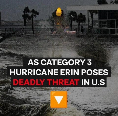
Hurricane Erin, previously a fierce Category 5 hurricane, has been downgraded to Category 3 but continues to pose a serious risk across the Atlantic and the U.S. East Coast. As of August 17, the National Hurricane Center (NHC) reports Erin sustaining winds of 125 mph (205 km/h), moving west-northwest at 13 mph (20 km/h). While slightly less intense, Erin remains a large, powerful, and extremely hazardous storm. Experts warn that the danger extends far beyond the storm’s eye—hurricane-force winds stretch nearly 50 miles from its center, with tropical-storm-force winds reaching over 200 miles, generating perilous surf, rip currents, and widespread coastal hazards.
In preparation, several North Carolina counties have declared states of emergency. Dare County has issued mandatory evacuations for Hatteras Island, starting with visitors and then residents, as officials anticipate Highway 12 may be submerged or damaged for days by 20-foot waves eroding beaches and dunes. Hyde County has issued similar evacuation orders for Ocracoke Island. Emergency authorities stress that once the full force of the storm arrives, rescue operations could become extremely difficult.
Meanwhile, Puerto Rico has experienced multiple days of heavy rainfall, with up to four additional inches expected. The Turks and Caicos Islands and Eastern Bahamas could receive six inches or more, increasing the risk of flash floods, mudslides, and hazardous coastal conditions. Tropical Storm Warnings are in effect, and residents are urged to take immediate precautions. Dangerous surf is already impacting the Virgin Islands, Hispaniola, and Puerto Rico, with swells expected to travel north toward Bermuda, Atlantic Canada, and the U.S. East Coast. Officials warn of deadly rip currents, coastal erosion, and localized flooding along exposed shorelines.
Although Erin is not forecast to make direct landfall in the U.S., its size and unpredictability demand caution. AccuWeather hurricane specialist Alex DaSilva notes that North Carolina’s Outer Banks, New York’s Long Island, and Massachusetts’ Cape Cod remain at high risk for direct impacts if the storm shifts slightly west. The Tri-State area, including New York, New Jersey, and Connecticut, could experience effects from Tuesday through Thursday, particularly along the Jersey Shore and Long Island’s southern coast. Inland regions are expected to see breezy, unsettled weather.
Erin’s threat is reminiscent of Tropical Storm Chantal, which struck the Southeast just weeks ago, causing flash floods, dangerous surf, and tornado watches despite weakening quickly. Erin, far stronger and larger, is anticipated to bring even more destructive conditions—even without a direct strike.
Federal officials urge East Coast residents to prepare immediately. The Department of Homeland Security’s Ready program recommends having a disaster plan, knowing evacuation routes, and packing an emergency “go-bag” with food, water, medication, and critical documents. With coastal waves predicted to overwhelm defenses and evacuations underway, hesitation could be deadly.
As Erin intensifies while turning northward, millions remain on alert. Its reduced strength does not lessen the risk—the storm’s vast reach and force make it one of the year’s most dangerous weather events. Authorities emphasize one message: prepare now to avoid being caught in the path of destruction.
Leave a Reply